The satellite designed by NASA and the Indian Space Research Organization (ISRO), known as NISAR (NASA-ISRO Synthetic Aperture Radar), was able to capture with unprecedented precision the scale and evolution of this phenomenon in different areas of the Mexican capital. The analysis is based on preliminary measurements taken from space between October 2025 and January of this year, during Mexico City’s dry season.
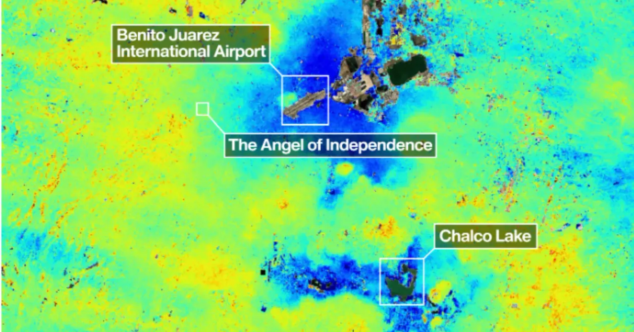
Their findings are captured in a map showing how the surface is changing beneath the surface of the city. NASA has identified in the map areas with subsidence greater than 2 cm per month (in dark blue). The agency specifies that the areas marked in yellow and red could correspond to background signals (or noise) that are expected to diminish as the satellite instrument collects more data.
The image also highlights the location of Benito Juarez International Airport, located near Lake Nabor Carrillo, which operates in an area experiencing rapid subsidence. “Images like these confirm that NISAR measurements are in line with expectations,” said Craig Ferguson, deputy project manager.
Mexico City lies above the bottom of a muddy lake and ancient Lake Texcoco. NASA explains that this process is the result of intense pumping of groundwater and the increasing weight associated with urban development. Both factors have compressed the ancient lake’s soil for more than a century.
This phenomenon was first documented in 1925 by engineer Roberto Gaiol. Between the 20th century and the 2000s, some areas saw a decline of about 35 centimeters per year, causing damage to infrastructure such as the metro, one of the largest mass transit systems in the Americas.
A study conducted in 2024 by Dario Solano Rojas, a specialist in remote sensing at the National Autonomous University of Mexico, found that the landing is not regular. After analyzing changes in the city’s elevation between 2011 and 2020, the researcher and his team concluded that subsidence rates are highly variable: while some areas record up to 50 cm per year, in others the phenomenon is almost imperceptible.
This creates “differential subsidence”, where the land sinks unevenly not just across square kilometers or city blocks, but even on the meter scale. When a street, railway or building sinks differently at one end than at the other, its stability is compromised.